📍 Field Updates: February 2026
Waterfall Platform Closed: The final steel staircase descending to the waterfall basin is currently restricted due to structural storm damage. Visitors may view the cascade from the upper perimeter trail, but the base is inaccessible.
Critical Connectivity Warning: Cellular signal is dead at the ranger station. You must purchase your entry pass via the SINAC website before you leave your hotel. Rangers cannot process payments on-site. No ticket, no entry.
Interactive Park Map & Location
While often marketed as a “Guanacaste excursion” due to its proximity to Liberia, Tenorio Volcano National Park geographically straddles the Alajuela border. The confusion often leads drivers astray. Use the map below to orient your approach; the turnoff from Route 6 in Bijagua and the turnoff from Route 4 in Katira are the two fully paved access points. Do not attempt “shortcuts” suggested by Waze that bypass the main entrance; they often lead to dead-end cow pastures.
The journey to Rio Celeste centers on the Tenorio Volcano National Park, situated between the small towns of Bijagua and Katira. This region serves as the intersection between the Guanacaste pampas and the lush Alajuela lowlands. While Bijagua is the closest commercial hub for lodging and dining, Upala serves as the larger administrative center further north. Navigating this area requires transitioning from major national highways to winding mountain roads that ascend into the cloud forest environment. Success in reaching the trailhead hinges on understanding that while the specific blue hue of the water is a result of optical physics, the logistics of getting there are a matter of pure geography and timing.
Choosing Your Arrival Airport
Travelers typically choose between Daniel Oduber Quirós International Airport (LIR) in Liberia and Juan Santamaría International Airport (SJO) in San José. Liberia is the preferred gateway due to its proximity; the drive is significantly shorter and less taxing. However, San José offers more frequent international flight options and is the better starting point if your Visitor Planning includes exploring the Central Valley or the Southern Pacific coast first. For those arriving at LIR, you are looking at an 80-kilometer transit. For those at SJO, the journey is a 200-kilometer trek through some of the country’s most congested mountain passes.
| Airport | Distance to Bijagua | Approx. Drive Time | Road Complexity |
|---|---|---|---|
| Liberia (LIR) | 80 km | 1.5 – 2 Hours | Moderate (Well-paved) |
| San José (SJO) | 200 km | 4.5 – 5 Hours | High (Mountainous/High-traffic) |
Public Bus Logistics: SJO and LIR Routes
The public transit system in Costa Rica is affordable but requires patience. If you are departing from the San José area, you must navigate to Terminal Atlántico Norte in downtown. Look for the counter operated by Transnorte de Upala. You will need a ticket for the bus heading toward the town of Upala, but you must explicitly ask the driver to drop you in Bijagua. The fare is approximately 6,500 CRC (roughly $12 USD). Expect the journey to take 5 hours as the bus climbs out of the Central Valley and maneuvers through the northern highlands.
From Liberia (LIR), there is no direct bus from the airport terminal to the park. You must take a local taxi or shuttle to the Liberia Municipal Bus Terminal. From there, board a direct bus toward Upala and get off in Bijagua. The total cost is roughly 3,500 CRC ($7 USD), making it the cheapest way to reach the region, though it is far from the fastest. Once in the center of Bijagua, you are still 9 kilometers from the park entrance. Since there is no Uber service in this remote area, you must hire a local “Transporte Privado” (Red Taxi or private 4×4) for $20–$30 USD for the final leg to the trailhead.
Driving Directions from Major Hubs
From Liberia (LIR)
Head east on Route 21 from the airport to Liberia, then south on Route 1 (the Inter-American Highway) toward Cañas. After approximately 45 minutes, look for the exit for Route 6 heading north toward Bijagua. This stretch of road is fully paved and offers striking views of the wind turbines that line the surrounding ridges. Route 6 is a scenic, rural two-lane highway until you reach the Bijagua town center, where you will turn toward the park entrance at the signed intersection.
From La Fortuna
The most direct drive is via Route 4 north through San Rafael de Guatuso, taking approximately 1.5 hours. Alternatively, you can drive west toward Lake Arenal via Route 142 and transition to Route 143, though this scenic detour takes much longer. If you prefer a more structured experience, shared shuttles and transport tours depart La Fortuna daily between 7:00 AM and 8:00 AM, typically costing between $75–$80 USD per person.
During the rainy season (May to November), a 4×4 vehicle is strongly recommended. While Route 6 and the 9km access road to the park (El Pilón) are now fully paved, many local eco-lodges are situated on steep, gravel side-roads that become treacherous after heavy tropical downpours.
Navigating the Final Mile
The specific road from Bijagua center to the Tenorio Volcano National Park entrance (known as the El Pilón sector) is now completely paved. However, it is characterized by steep inclines that can stress a standard sedan’s engine. Once you arrive, parking is managed by local associations and typically costs 2,000 CRC. If you are visiting during peak holidays like Christmas or Easter, the park’s 500-person concurrent capacity limit becomes a major factor. If 500 people are already on the trail, the rangers operate a strict “one-out, one-in” policy. To avoid a 2-hour wait at the gate, aim to arrive before 9:00 AM.
Directly across from the park entrance, you will find vendors offering mud boot rentals for 2,500 CRC ($5 USD). Do not decline these. Even in the dry season, the volcanic soil at the *Teñideros* section of the hiking trail remains perennially swampy. If you are looking for a place to swim—which is strictly prohibited inside the park—continue 1 kilometer past the main entrance to the Poza del Río Celeste. This is a public bridge where you can legally access the blue water for free.
Regional Transit FAQ
- Is there public transportation directly to the Rio Celeste trailhead? No, public buses only go as far as the Bijagua town center or the Upala hub. To reach the actual park entrance, you must hire a local 4×4 taxi from Bijagua, which typically costs between $30 and $40 USD depending on your negotiation skills and the time of day.
- Are the roads paved all the way to the Tenorio Volcano National Park? Yes, the main access via Route 6 and the subsequent 9km winding road from Bijagua to the El Pilón entrance are now fully paved. While a 4×4 is not strictly required for the pavement, it is highly recommended for safety on steep inclines and for accessing nearby attractions in Bijagua that sit on unpaved side roads.
- How far is Rio Celeste from Tamarindo and the Guanacaste beaches? The drive from Tamarindo takes approximately 3 hours one way, primarily via Route 21 and Route 1. We strongly advise leaving no later than 6:00 AM to ensure you beat both the heat and the afternoon clouds which can lead to the “brown water” phenomenon caused by rain.
- Can I use Waze or Google Maps to find the entrance? Both navigation apps work reliably in this region of Costa Rica, though you should specifically search for “Tenorio Volcano National Park” rather than just “Rio Celeste.” Using the park name ensures you are directed to the official SINAC ranger station where pre-purchased tickets are scanned (note that tickets are no longer sold at the gate and must be bought online in advance via the SINAC website), rather than a random point along the river.
- Where is the closest gas station to the park? The final reliable gas stations are located in the center of Bijagua. You should ensure your tank is at least half full before beginning the steep 9km climb to the park entrance, as there are no fuel services available once you leave the village limits.
For more information on maximizing your time in the northern highlands, check out our guide on how to spot sloths in the Bijagua biological corridor or review our tipping guide for local transport services.
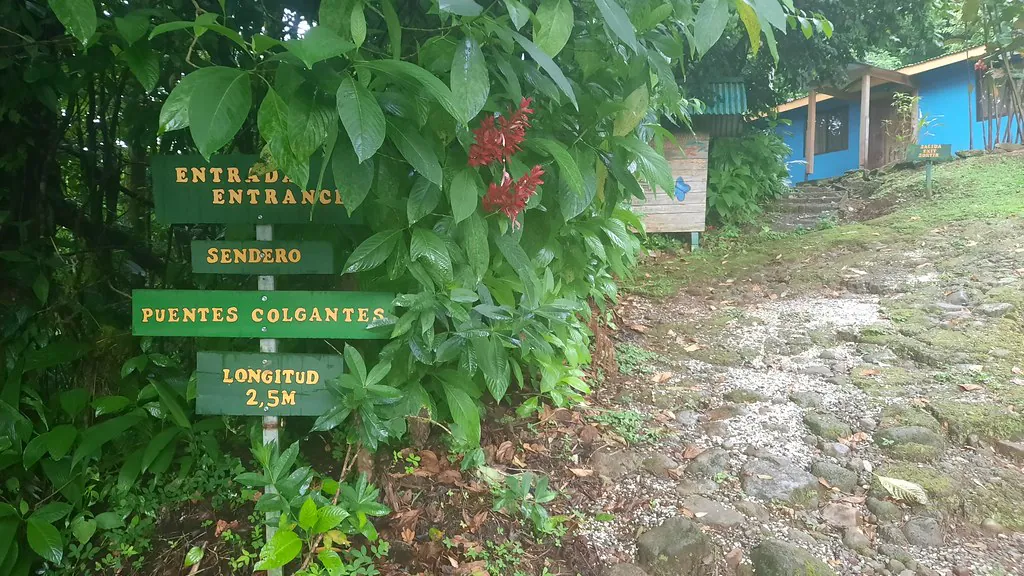
Internal Trail Map & Sector El Pilón
The geography of the park is strictly linear. From the ranger station, a single 3.7-mile (6km) out-and-back trail cuts through the cloud forest; there is no loop. Use these markers to gauge your stamina against the daylight.
- Kilometer 1.5 – Catarata (Waterfall): The paved path terminates here. Access involves a descent of 250 concrete steps. Note: As of February 2026, the lower steel viewing platform is compromised. Do not cross the yellow perimeter tape; view the drop from the upper rim.
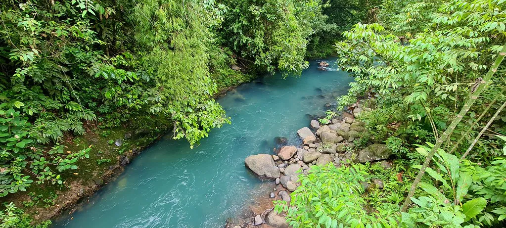
- Kilometer 2.0 – La Laguna Azul: A stagnant section of the river where the current stalls, allowing suspended aluminosilicate particles to reflect the maximum spectrum of blue. Swimming here is strictly prohibited by national law.
- Kilometer 2.5 – Los Borbollones: Volcanic sulfur gases escape through the riverbed, creating boiling ‘hot pots.’ The smell is rot; the water is scalding.
- Kilometer 3.0 – El Teñidero: The end of the line. Here, the clear Rio Buenavista meets the acidic Quebrada Agria. The sudden drop in pH causes mineral particles to aggregate and scatter sunlight, creating the optical phenomenon of the blue water.