Driving in Costa Rica: Roads, Rains, and Rentals
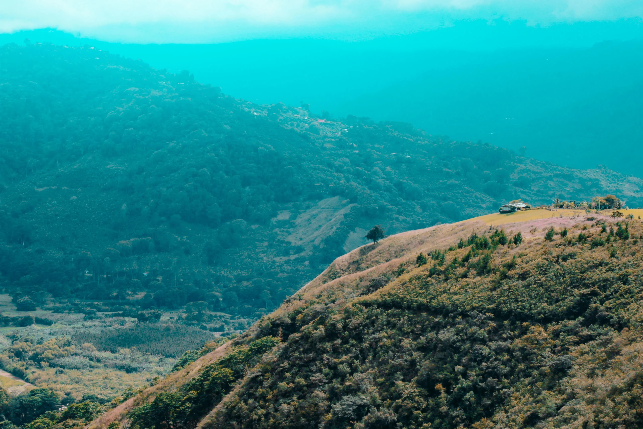
Driving to Rio Celeste and through the Northern Highlands is an exercise in “defensive awe.” The journey transitions from the high-speed transit of the Pan-American Highway to winding, emerald-canopied corridors where the infrastructure is as temperamental as the weather. It is a rewarding experience that offers total freedom to explore remote trailheads, but it demands a driver who is comfortable with steep 12% gradients, sudden tropical downpours, and the occasional need to engage 4×4 not for mud, but for the sheer grip of wet concrete. Navigating the roads toward the Teñideros is a journey of dramatic transitions, beginning on the smooth, sun-drenched stretches of Route 1 before ascending into the misty, emerald highlands of the Tenorio-Miravalles corridor.
Success here isn’t just about reaching the destination; it’s about understanding the unspoken rules of the road, from the etiquette of one-lane bridges to the strategic ‘fuel gaps’ that catch many travelers off guard.
Essential Arteries and the “Costa Rican Massage”
Route 6: The Bijagua Gateway
This is the primary artery for those arriving from Liberia or the Pacific coast. The drive from the Inter-American Highway (via Cañas) up to Bijagua is fully paved and offers striking views of the wind turbines that line the surrounding ridges. Route 6 is a high-speed transit until you reach the Bijagua town center, though drivers should remain cautious during heavy tropical downpours.
- The Climb: The route is hilly at times but offers smooth driving on nice pavement, avoiding the extreme gradients and hairpin turns found on other mountain passes.
- Brake Management: While the descent is manageable and does not require constant low-gear downshifting, standard caution is recommended.
- Wildlife Hazards: Coatimundis and cattle are frequent visitors; in the Tenorio-Miravalles corridor, you may even encounter crossing tapirs at dusk.
Navigation Tactics and the Waze Trap
The ‘Waze’ Way of Life
In Costa Rica, Google Maps is a distant second to Waze. The local community uses Waze to report everything from temporary flooding to police checkpoints and fallen trees. However, in the Upala/Bijagua region, Waze often suggests “shorter” routes that involve unbridged river crossings or private farm roads (servidumbres). Navigation in the Northern Highlands requires a steady data connection, as backroads can shift from ‘passable’ to ‘riverbed’ after a heavy afternoon storm.
“The Green Rush”—the urgency to reach the National Park entrance before the clouds roll in—must be balanced with the slow, rhythmic reality of rural Tico life. Stick to Route 6 or Route 4 to avoid getting a rental SUV stuck in a volcanic riverbed.
Rental Realities: Legalities and Vehicle Choice
Selecting the right vehicle for the Bijagua region is not about luxury; it is about clearance. While many roads to Bijagua are paved, the final kilometers to specific eco-lodges or hidden trailheads near the Miravalles Volcano involve unpaved gravel (lastre). We strongly recommend a high-clearance 4WD vehicle for the Tenorio region. Beyond the mechanics, you must understand the legal paperwork. Ensure your rental has the current Marchamo (circulation permit) sticker on the windshield. If the Transit Police (Tránsito) stop you, they will demand the physical Rental Contract. Digital copies on your phone are often rejected.
The 4×4 Necessity
- Insurance: Mandatory Third Party Liability (TPL) is required by law; CDW is often extra.
- Fuel Strategy: Fill up in Cañas or Upala center. The gas station in Bijagua typically closes by 8:00 PM or 9:00 PM. Never head to the park with less than a quarter tank.
- Pinchazos (Tire Repair): Gravel roads near the park are notorious for “sharp” volcanic rock. Look for signs saying “Llantera” or “Pinchazo” in Bijagua for $10–$15 rapid repairs.
The Night Driving Warning
While most rental insurance policies in Costa Rica do not strictly void coverage based on the time of day, experts strongly advise against driving on unpaved roads after 6:00 PM. This isn’t just a cautious suggestion; it’s a response to the “neblina” (heavy fog) common in the Tenorio highlands. As the sun sets, visibility can drop to less than five feet. If you are staying at a lodge near the park, plan to be off the gravel roads by dusk. Driving here at night also increases the risk of hitting wandering livestock or missing a sudden pothole carved by the day’s tropical rainfall.
Local Driving Etiquette
The “Costa Rican massage” refers to the vibrating sensation of driving over washboard gravel, but the true local flavor comes from the “CEDA” bridge protocol. On the secondary roads leading to Bijagua, you will frequently encounter narrow, one-way bridges. Understanding the hierarchy of these bridges is vital for safety and cultural integration.
| Scenario | Local Protocol |
|---|---|
| One-Lane Bridge (Puente Angosto) | The side with the “CEDA” (Yield) sign must wait. However, a flash of headlights from oncoming traffic often means “Go ahead; I am yielding.” |
| Heavy Rain/Fog | Pull over if visibility drops. Hazards (flashing lights) are used to indicate you are moving slowly, not necessarily that you are stopped. |
| Tractors & Cattle | Patience is mandatory. The “Vaqueros” (cowboys) will signal you forward with a hand gesture once they have cleared a path. Do not honk. |
| The “Llantera” Sign | Indicates a local tire repair shop. These are ubiquitous in rural areas and significantly faster than waiting for agency roadside assistance. |
Geothermal Landmarks & Route 4
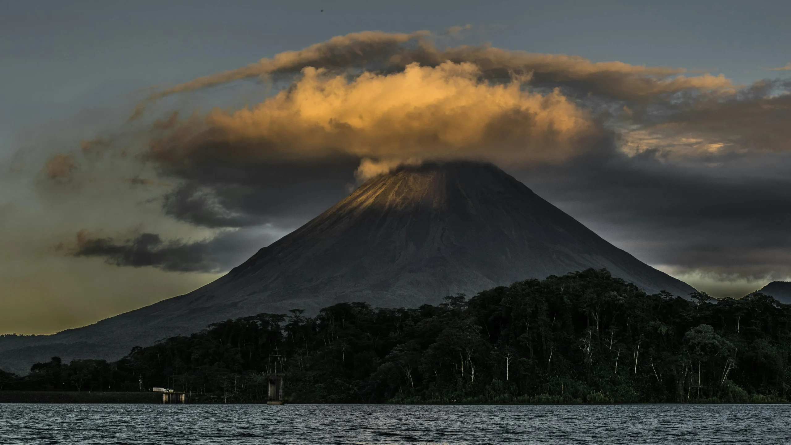
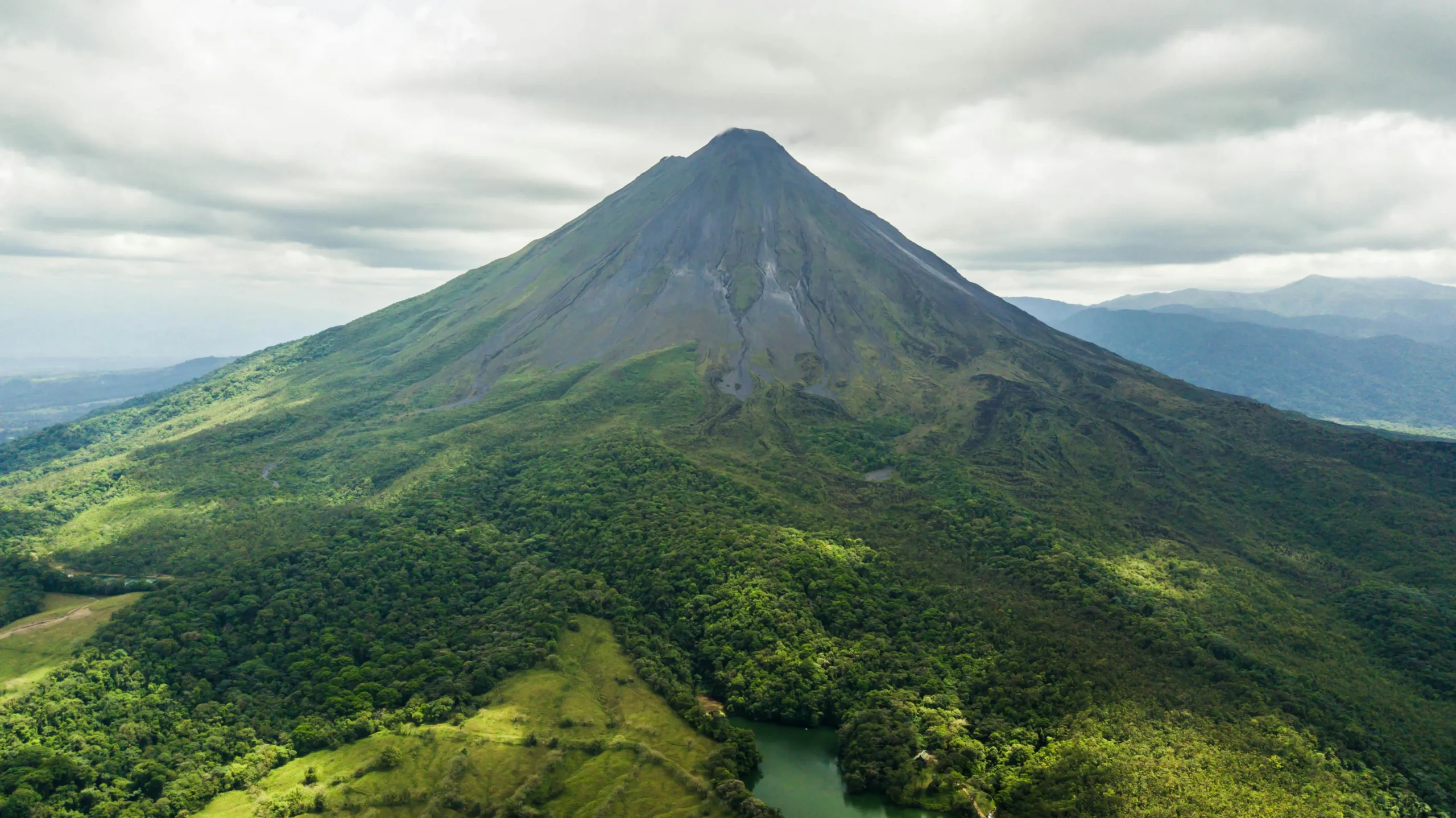
If you are arriving via the Northern Corridor (Route 4), the road is flatter but prone to heavy truck traffic. Always keep your headlights on, even during the day, as sudden cloud banks can roll in from the Miravalles volcano without warning. If you take a detour south along Route 164, you will drive past the heart of Costa Rica’s green energy initiative. Look for massive silver pipes weaving through the jungle; these carry volcanic steam to the ICE Geothermal Plant. This region powers a significant portion of the country.
Top Regional Tours & Experiences

Rio Celeste Waterfall Hike from Arenal
⭐ Professional local guide included
🔥 Booked 10 times this week

Tubing in Rio Celeste
⭐ Professional local guide included
🔥 Booked 11 times this week

Río Celeste Nature Hike and Swimming experience at the blue river
⭐ Professional local guide included
🔥 Booked 12 times this week

Tubing in Rio Celeste
⭐ Professional local guide included
🔥 Booked 13 times this week

La Fortuna Night Walk in High Biodiversity Rainforest
⭐ Professional local guide included
🔥 Likely to sell out soon!

White Water River Rafting Class II-III from La Fortuna-Arenal
⭐ Professional local guide included
🔥 Booked 15 times this week
Frequently Asked Questions
Do I absolutely need a 4×4 for the drive to Rio Celeste?
While the main road to the town of Bijagua and the final stretch to the Tenorio Volcano National Park entrance are now fully paved, some surrounding eco-lodges may have rough gravel driveways with steep inclines. During the rainy season, these surfaces become slick and unpredictable. While a 4WD is no longer essential for reaching the park, a high-clearance vehicle is still highly recommended for comfort and to avoid voiding your rental insurance on unpaved side roads.
Is it safe to drive from San José to Rio Celeste at night?
We strongly advise against driving this route after 6:00 PM due to the lack of street lighting and the prevalence of thick mountain fog in the highlands. Furthermore, many rental car insurance policies do not cover accidents on unpaved roads after dark, leaving you financially liable for any damages if you are staying at a remote lodge.
What should I do if I get a flat tire on a gravel road?
You should look for a local tire repair shop marked with a “Llantera” or “Vulcanizadora” sign, which are common in rural Bijagua. These shops can usually patch a tire for $10–$15 in less than twenty minutes, which is far more efficient than waiting hours for a rental agency’s roadside assistance in a remote area.
Are there gas stations near the Rio Celeste park entrance?
There are no gas stations at the actual park entrance; the nearest reliable fuel is at the local gas station in Bijagua or in the larger hubs of Upala and Cañas. The Bijagua station often closes by 9:00 PM, so it is critical to top off your tank before heading into the more remote volcanic corridors for the night.
How do I handle the one-way bridges on the way to the park?
When approaching a one-way bridge (Puente Angosto), look for the “CEDA” sign on your side of the road; if it is there, you must yield to oncoming traffic. It is local custom to flash your headlights to acknowledge other drivers or to signal that you are entering the bridge if the path is clear.
For more details on navigating the region’s transit hubs, visit our comprehensive transportation guide or check the seasonal weather reports to see how rain affects road conditions.